| ||||||||||
 

Dr. Ronald P. Rogers CHIROPRACTOR Support for your body's natural healing capabilities 270-384-5554 Click here for details 


Columbia Gas Dept. GAS LEAK or GAS SMELL Contact Numbers 24 hrs/ 365 days 270-384-2006 or 9-1-1 Call before you dig 
Visit ColumbiaMagazine's Directory of Churches Addresses, times, phone numbers and more for churches in Adair County Find Great Stuff in ColumbiaMagazine's Classified Ads Antiques, Help Wanted, Autos, Real Estate, Legal Notices, More... 


|
Travis Garmon: On Caney Fork Creek bed of creek 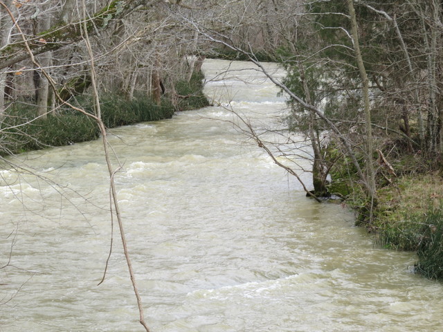 He offers one correction: Creek Beds called 'slate rock' in this area are usually 'shale." He thinks phenomenon on Caney Fork Creek, at a point alongside KY 1913 in Green County result ancient fault system split, not by the relatively recent New Madrid Earthquakes
Click on headline for complete essay By Travis Garmon Please allow me to offer one correction to the Caney Fork Creek article: The bottom unit in the bed of the creek is a shale, not a slate. This is a very common misconception in the area, and I'm not sure how it got started or propagated so completely throughout the region. Shales are sedimentary rocks that are composed primarily of clay and organic carbon, deposited in deep marine environments, deep lakes, and swamp-like areas. Slates are metamorphic rocks, formed by the heating and compression of shales and other clay-rich rocks during deep burial or mountain-building events. There is no evidence to suggest that the near-surface rocks in present-day south-central KY were ever subjected to any degree of metamorphism, and thus most any rock units in the area referred to as "slate" are in fact most likely shales. Most like process for phenomenon fault-system which split That said, the phenomenon observed in the bed of Caney Fork Creek could have been caused by a number of processes. The most likely result is that they are part of a fault system (likely long-since deactivated), which split the rock unit and forced one side to rise with respect to the other. Without seeing any photographs, it is difficult to say if this is part of a normal or reverse fault system though. Faults are actually quite common in the area, and are even visible in certain road-cuts. In particular, a number of faults are plainly visible in several road cuts in Cumberland County along highway 61, about 2.5-3 miles south of the Adair County line. These same road cuts also feature some paleo-river channels, and numerous crinoid fossils can be found within them. South Central Kentucky underlain by Cincinnati Arch South-central KY is underlain by a large structural feature known as the Cincinnati Arch, which is a shallow fold in the deeper rock units that formed during the uplift of the Appalachian Mountains. The arch runs roughly north-northeast to south-southwest throughout the area, from Cincinnati, OH toward Nashville, TN. In addition, there is a second deep fold that runs under the area, roughly east to west, known as the Cumberland Saddle. This fold is more of a sag than an arch. When rocks are folded by tectonic processes, a large number fractures and faults form as a result along the crest of the fold. Arches (known as anticlines) tend to stretch rocks along the crest, resulting in normal faults; while sags (known as synclines) tend to compress them slightly, resulting in reverse faults. Evidence of deformations visible in cuts along KY 61 and KY 55 There is some visible evidence for these deformations visibly at the surface just south of Columbia, KY as well. Rock strata visible in outcrops/road-cuts just south of Columbia along highways 61 and 55 can be seen to be tilted (also known as "dipping") relative to ground level and overlying strata. The contact with the dipping lower strata and the flat-lying upper strata is known as an angular unconformity. Unconformities are geologic "gaps", where there is either a period of erosion or non-deposition. This is formed by the tilting of previously deposited sediments (most of the sediments in this region were deposited underwater, in a shallow sea environment), followed by erosion (relative sea level falls, exposing the sediments at the surface). After the strata are tilted and eroded, more sediments are deposited (following a sea-level rise again) in flat-lying units. Caney Fork features likely result of ancient/local fault movement Personally, I would suspect that the features observed in the bed of the Caney Fork Creek are the result of ancient local/regional fault movement, not the more recent New Madrid movement. But, I can't rule that hypothesis out either. An additional possibility is simply that the ledges formed during a time when a stream ran in the opposite direction to the current creek, but various erosional and depositional periods have created a stream in the same location that now happens to flow in the current direction. I doubt that though, as the shale units in this area are far more resistant to erosion than the more common limestones. If you have any further photos of the stream bed, or any photos of nearby outcrops showing offset, then I would very much like to see them. Thank you, - Travis Garmon Comments re photo 65057 Caney Fork Creeks geological oddity Earthquake This story was posted on 2016-02-26 17:14:05
Printable: this page is now automatically formatted for printing.
Have comments or corrections for this story? Use our contact form and let us know. (AD) - Many Reunion organizing efforts are also advertised in our REUNIONS category in our CM Classifeds. These are posted at a very low cost. See RATES & TERMS
More articles from topic Local History:
JIM: 100 years ago the News called for Cleaner Columbia Query: History of landmark Milltown House Danger lurking: the perils of drink JIM: Wheats, Williams families of Montpelier, KY store Tax check-off program to help KY communities showcase history Billy Collins comments on School which never was Russell Co., KY: Memories of Gosser Ridge / Green River Knob Brawner-Smith Cemetery comment: Nancy Ann Speake Mr. Marshburn researches meaning of Fairplay family name Walter Montgomery (1886-1901) died of spinal meningitis View even more articles in topic Local History |
 

115 Jamestown St. Columbia, KY. 270-384-2496 


 Provided by the Adair Co Fiscal Court and the Adair Co. Emergency Mgt. Agency 


|
||||||||
|
| ||||||||||
|
Quick Links to Popular Features
Looking for a story or picture? Try our Photo Archive or our Stories Archive for all the information that's appeared on ColumbiaMagazine.com. | ||||||||||
|
Contact us: Columbia Magazine and columbiamagazine.com are published by Linda Waggener and Pen Waggener, PO Box 906, Columbia, KY 42728. Please use our contact page, or send questions about technical issues with this site to webmaster@columbiamagazine.com. All logos and trademarks used on this site are property of their respective owners. All comments remain the property and responsibility of their posters, all articles and photos remain the property of their creators, and all the rest is copyright 1995-Present by Columbia Magazine. Privacy policy: use of this site requires no sharing of information. Voluntarily shared information may be published and made available to the public on this site and/or stored electronically. Anonymous submissions will be subject to additional verification. Cookies are not required to use our site. However, if you have cookies enabled in your web browser, some of our advertisers may use cookies for interest-based advertising across multiple domains. For more information about third-party advertising, visit the NAI web privacy site.
| ||||||||||