| ||||||||||
 

Dr. Ronald P. Rogers CHIROPRACTOR Support for your body's natural healing capabilities 270-384-5554 Click here for details 


Columbia Gas Dept. GAS LEAK or GAS SMELL Contact Numbers 24 hrs/ 365 days 270-384-2006 or 9-1-1 Call before you dig 
Visit ColumbiaMagazine's Directory of Churches Addresses, times, phone numbers and more for churches in Adair County Find Great Stuff in ColumbiaMagazine's Classified Ads Antiques, Help Wanted, Autos, Real Estate, Legal Notices, More... 


|
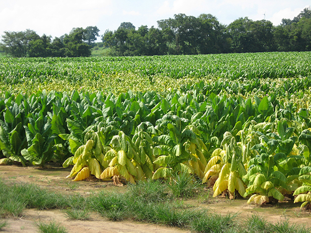
State climatologist documenting impact of July's record rainfall 11 Mesonet stations recorded 15+ inches of rain in July Bowling Green, KY - State climatologist Stuart Foster spent his day Tuesday traveling across western Kentucky to get a closer look at the impact of July's record-breaking rainfall. The statewide average for July rainfall is 4.43 inches, but nearly two dozen Kentucky Mesonet at WKU stations recorded more than 10 inches of rainfall in July (including 11 sites with more than 15 inches) and the preliminary Mesonet average was 9.69 inches, said Dr. Foster, who is director of the Mesonet and the Kentucky Climate Center at WKU. The Mesonet has 66 stations in 65 counties. Mesonet sites recording the most rainfall in July were: Christian County, 18.26; Calloway County, 17.06; Logan County, 16.90; Hopkins County, 16.38; Marshall County, 16.25; Butler County, 16.05; Crittenden County, 15.87; Trigg County, 15.76; Ohio County, 15.75; Todd County, 15.68; and Muhlenberg County, 15.60. Similar totals were recorded at stations that are part of the National Weather Service Cooperative Observer Network. "We are still analyzing data, but one thing is clear, rainfall totals for July 2016 shattered records at numerous locations," he said. For example, the cooperative observer station at Murray, which opened in 1926, recorded 18.43 inches, breaking the previous record by more than 7 inches. Interestingly, many of the records that were broken had been set in 2015. The weather pattern for July was characterized by many periods of unsettled weather. High humidity and soil moisture, coupled with the lack of a strong jet stream over the region, contributed to the repeated development of slow-moving thunderstorms that dumped copious amounts of rain. "In most years, a given location in western Kentucky does not record a single day in July with a total rainfall exceeding 2 inches," Dr. Foster said. "On average, such an event occurs about once every four or five years. In 2016, many locations received 2 inches or more of rain on four different days of the month, more than in any July on record. "While this marked the second consecutive July that produced record-breaking precipitation, this is an event that we probably won't see again in our lifetime," he said. "Given concerns about projections of a changing climate, however, it's important not just to look at the data showing how much rain fell but to document the impact of that rain and what it meant for the communities and areas that experienced that rainfall." Critically, given the time of year and the location of the heaviest rainfall, widespread river flooding did not occur. Instead, the heavy rain caused flash flooding that damaged roads and crops in several counties. While the extent of crop loss will not be known until harvest, ponding of water in low-lying areas and on poorly drained soils will reduce yields. In upland areas, crops, including tobacco, planted on sloping fields were vulnerable to being washed out. But during his trip across the region, Dr. Foster noted that corn, soybeans and pastures in many areas are benefiting from the above-average July rainfall. Talking with farmers and local officials to document the impact from July's record rainfall is important as the region experiences more extreme climate and weather events, Dr. Foster said. "We've seen some extreme fluctuations in climate conditions for Kentucky in the past decade," he said. "The ability of things to swing back and forth is evidenced by looking at 2011 and 2012." In Kentucky, 2011 was the wettest year on record (statewide average of 64.34 inches) with heavy rains in April and May causing major flooding along the lower Ohio River, he said. "Then one year later in 2012 we had record warmth in March followed by intense heat and drought concentrated in the western part of the state," Dr. Foster said. "We went from extreme wet to extreme drought within a year." Does that mean 2017 will be a dry year? It's too early to tell, he said. "Many of our recent droughts in Kentucky have occurred during La Nina events. As the strong El Nino of last winter has waned, the outlook is for La Nina conditions to develop into the fall and winter," he said. "However, the uncertainty of this outlook from the Climate Predication Center has increased over the past several weeks." Kentucky Mesonet at WKU stations with July 2016 precipitation totals of more than 10 inches:
The Mesonet's statewide network includes stations in Adair, Allen, Barren, Bath, Boone, Breathitt, Breckinridge, Bullitt, Butler, Caldwell, Calloway, Campbell, Carroll, Casey, Christian, Clark, Clinton, Crittenden, Cumberland, Fayette, Franklin, Fulton, Graves, Grayson, Hardin, Harlan, Harrison, Hart, Henderson, Hopkins, Jackson, Johnson, Knott, Knox, LaRue, Lawrence, Letcher, Lewis, Lincoln, Logan, Madison, Marion, Marshall, Mason, McLean, McCreary, Meade, Mercer, Metcalfe, Morgan, Muhlenberg, Nicholas, Ohio, Oldham, Owen, Owsley, Pike, Rowan, Shelby, Simpson, Taylor, Todd, Trigg, Union and Warren counties. This story was posted on 2016-08-04 18:56:21
Printable: this page is now automatically formatted for printing.
Have comments or corrections for this story? Use our contact form and let us know.
More articles from topic Kentucky:
Beware of Free Ocean Cruise Scam Judge Orders Georgetown Cemetery Owner to Repay Customers Patriot Brands to build distillery, history park in Pleasureville Beshear provides $450,000 to Transitions Inc. Pine Mountain State Resort Park re-opens Bevin, Heiner announce $100 Million Work Ready Skills Initiative Kentucky Fish and Wildlife acquires property in Pulaski County Ground broken on 310-job baking facility in Versailles Work Opportunity Tax Credit for employers reauthorized State's First Veterans Center to celebrate 25th anniversary View even more articles in topic Kentucky |
 

115 Jamestown St. Columbia, KY. 270-384-2496 


 Provided by the Adair Co Fiscal Court and the Adair Co. Emergency Mgt. Agency 


|
||||||||
|
| ||||||||||
|
Quick Links to Popular Features
Looking for a story or picture? Try our Photo Archive or our Stories Archive for all the information that's appeared on ColumbiaMagazine.com. | ||||||||||
|
Contact us: Columbia Magazine and columbiamagazine.com are published by Linda Waggener and Pen Waggener, PO Box 906, Columbia, KY 42728. Please use our contact page, or send questions about technical issues with this site to webmaster@columbiamagazine.com. All logos and trademarks used on this site are property of their respective owners. All comments remain the property and responsibility of their posters, all articles and photos remain the property of their creators, and all the rest is copyright 1995-Present by Columbia Magazine. Privacy policy: use of this site requires no sharing of information. Voluntarily shared information may be published and made available to the public on this site and/or stored electronically. Anonymous submissions will be subject to additional verification. Cookies are not required to use our site. However, if you have cookies enabled in your web browser, some of our advertisers may use cookies for interest-based advertising across multiple domains. For more information about third-party advertising, visit the NAI web privacy site.
| ||||||||||