| ||||||||||
 

Dr. Ronald P. Rogers CHIROPRACTOR Support for your body's natural healing capabilities 270-384-5554 Click here for details 


Columbia Gas Dept. GAS LEAK or GAS SMELL Contact Numbers 24 hrs/ 365 days 270-384-2006 or 9-1-1 Call before you dig 
Visit ColumbiaMagazine's Directory of Churches Addresses, times, phone numbers and more for churches in Adair County Find Great Stuff in ColumbiaMagazine's Classified Ads Antiques, Help Wanted, Autos, Real Estate, Legal Notices, More... 


|
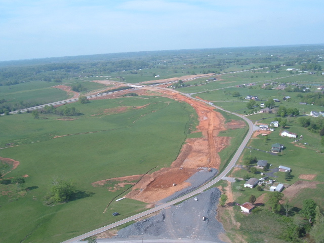
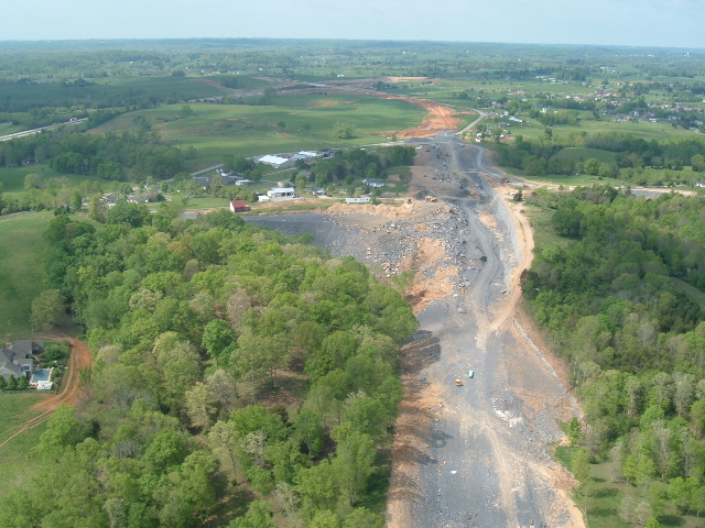
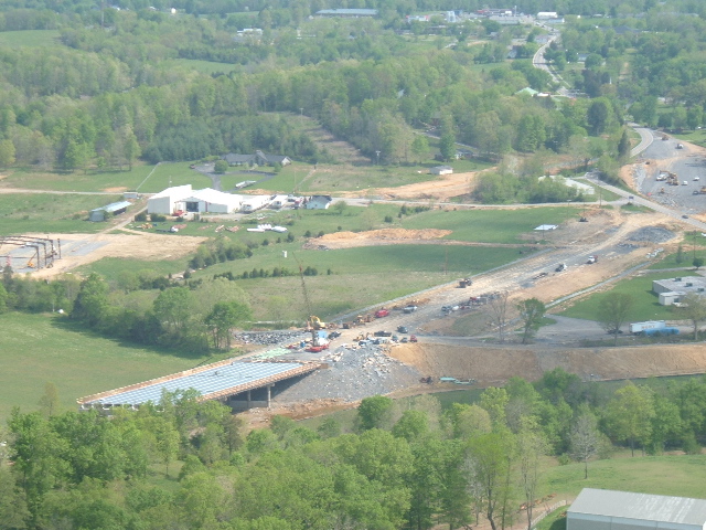
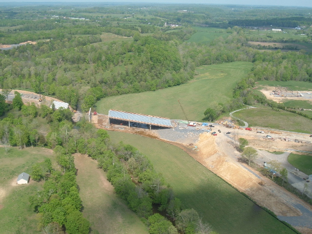
Donald Hare sends 5 dramatic photos of KY 61, Interchange construction Five dramatic aerial photos of the construction on the new Louie B. Nunn Parkway Interchange with KY 61 South and the new KY 61 construction are now posted and follow this story. Donald Hare, a Flight Parmedic with Air Evac-43, took the photos while aboard the unit's helicopter, flying at 135 miles an hour. The unit was in Columbia today to take part in a Mock Disaster exercise at Adair County High School, in conjunction with the Adair County EMS and other public safety organizations. Mr. Hare is a resident of Campbellsville, KY. Our thanks to him for sharing the photos with the readers of ColumbiaMagazine.com. This story was posted on 2006-04-24 17:10:53
Printable: this page is now automatically formatted for printing.
Have comments or corrections for this story? Use our contact form and let us know.
More articles from topic Adair County:
He's gone again. Christian Wheeler takes keys, deputy jailer's Jeep. Big Breeding Event TODAY! : Fish Fry, Stump Speaking, Auction Adair High School student taken into custody in weapons case Spotting of white squirrel exciting Conover Lane folks Adair Co. Justice Center Project Development Board meets Tuesday, April 25, 2006 Taylor County Man arrested for Adair horse trailer theft Jury convicts Constable ''Kennybuck'' Downey on three counts Results: April 18 to 19, 2006 poll on local government spending DAVID HERBST: 10 Tips for profitable cash hay operations Adair CO Fiscal Court Agenda Special Called Meeting April 27, 2006 View even more articles in topic Adair County |
 

115 Jamestown St. Columbia, KY. 270-384-2496 


 Provided by the Adair Co Fiscal Court and the Adair Co. Emergency Mgt. Agency 


|
||||||||
|
| ||||||||||
|
Quick Links to Popular Features
Looking for a story or picture? Try our Photo Archive or our Stories Archive for all the information that's appeared on ColumbiaMagazine.com. | ||||||||||
|
Contact us: Columbia Magazine and columbiamagazine.com are published by Linda Waggener and Pen Waggener, PO Box 906, Columbia, KY 42728. Please use our contact page, or send questions about technical issues with this site to webmaster@columbiamagazine.com. All logos and trademarks used on this site are property of their respective owners. All comments remain the property and responsibility of their posters, all articles and photos remain the property of their creators, and all the rest is copyright 1995-Present by Columbia Magazine. Privacy policy: use of this site requires no sharing of information. Voluntarily shared information may be published and made available to the public on this site and/or stored electronically. Anonymous submissions will be subject to additional verification. Cookies are not required to use our site. However, if you have cookies enabled in your web browser, some of our advertisers may use cookies for interest-based advertising across multiple domains. For more information about third-party advertising, visit the NAI web privacy site.
| ||||||||||